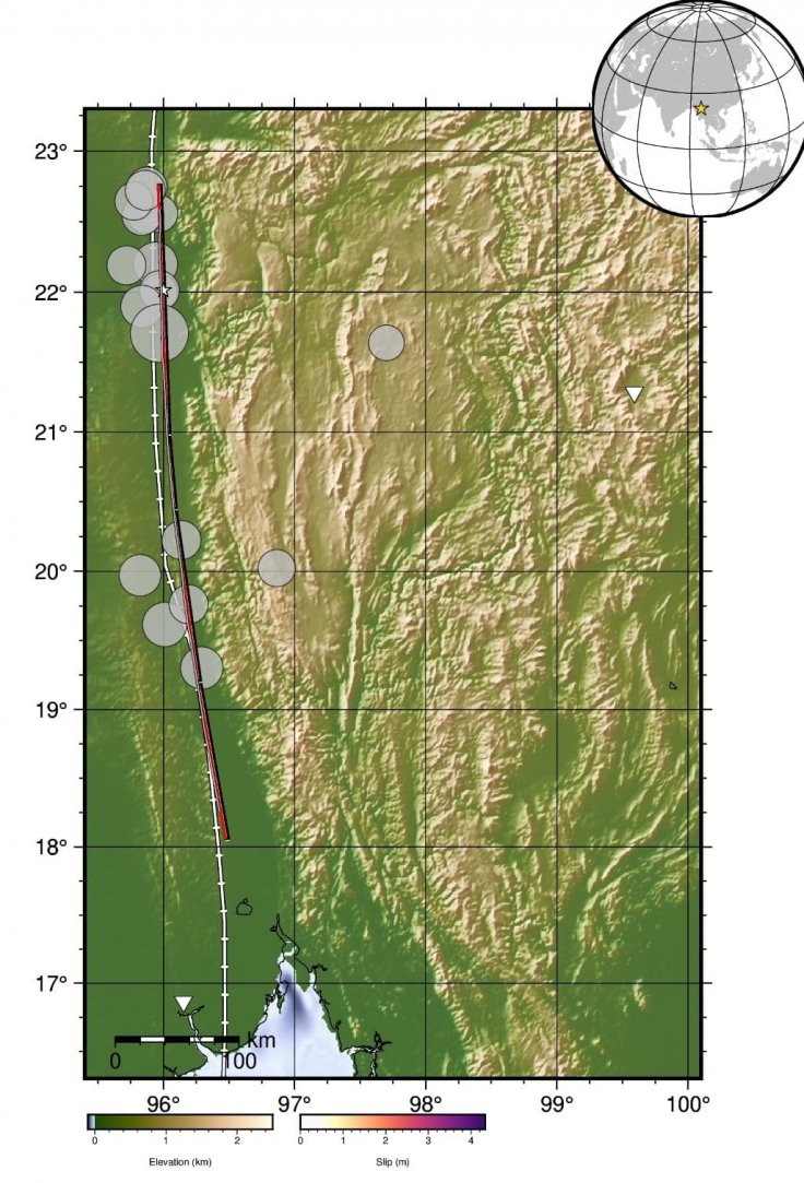
A powerful 7.7-magnitude earthquake struck Myanmar last Friday, leaving widespread destruction and a rising death toll surpassing 3,000. The quake's epicenter was near Mandalay, Myanmar's second-largest city, and triggered an enormous surface rupture extending approximately 500 kilometers. Scientists are shocked by the sheer scale of the rupture, one of the longest ever recorded in Southeast Asia.

Unprecedented Rupture Baffles Experts
Newly released satellite imagery from Maxar, processed by Nahel Belgherze, reveals the geological upheaval. The rupture, extending from central Myanmar into the eastern border region, exhibits a fault slip of up to five meters in places. Seismologists are stunned by the magnitude of displacement, which is exceptionally rare for earthquakes of this type. Such an extensive rupture suggests a colossal release of tectonic stress that could impact Myanmar's seismic activity for decades.
"A rupture of this length is extraordinary," said Dr. Rebecca Bell, a tectonics specialist at Imperial College London. "It indicates extreme stress buildup along the fault, possibly linked to broader regional tectonic shifts. The energy released was immense, explaining the vast destruction."
The Sagaing Fault and Supershear Impact
The rupture occurred along the Sagaing Fault, a major tectonic boundary cutting north-south through Myanmar. Scientists note that its "supershear" nature—where the rupture moves faster than seismic waves—intensified destruction. This phenomenon, similar to a supersonic jet breaking the sound barrier, concentrates seismic energy, making the earthquake more powerful than initially expected.
Myanmar is one of the most seismically active regions in the world, sitting at the convergence of four tectonic plates: the Eurasian, Indian, Sunda, and Burma microplate. Past disasters, including the 2004 Indian Ocean tsunami, were also linked to plate movements in the region.
Devastation Across the Region
The earthquake, one of the most powerful to hit Myanmar in a century, devastated a region home to 28 million people. Buildings, including hospitals, collapsed, entire communities were flattened, and survivors struggle for basic necessities like food, water, and shelter. The tremors were felt far beyond Myanmar, causing significant damage in Thailand, China, and Vietnam.
Satellite imagery plays a critical role in assessing the damage. Data shows significant horizontal displacements in both east-west and north-south directions, confirming the rupture's unprecedented scale. The highest fault slips were recorded near Mandalay, making it the worst-hit area.
Aftershock Fears and Future Risks
The earthquake's shallow depth—just 10 kilometers below the surface—made its impact even more severe. It produced more energy than the Hiroshima atomic bomb, according to the U.S. Geological Survey. Scientists remain concerned about aftershocks.
"There's always a risk of significant aftershocks following such a massive rupture," said Dr. Emily So, an earthquake engineering expert at Cambridge University. "These can cause further damage and must be closely monitored."
As Myanmar struggles with this disaster, experts warn that future seismic activity could be even more devastating. The massive rupture has altered stress distributions along the fault, potentially setting the stage for more quakes in the future.
Humanitarian and Government Response
Myanmar's military government has declared a temporary ceasefire until April 22 to allow relief operations. Armed resistance groups have made similar declarations. However, unseasonal rain threatens to hinder rescue efforts and increase the risk of disease outbreaks.
With thousands homeless and critical infrastructure destroyed, the response to this disaster will require extensive international aid. Scientists and humanitarian organizations continue to assess the long-term impact of the 500-km rupture, hoping to prevent further tragedies in this earthquake-prone region.


